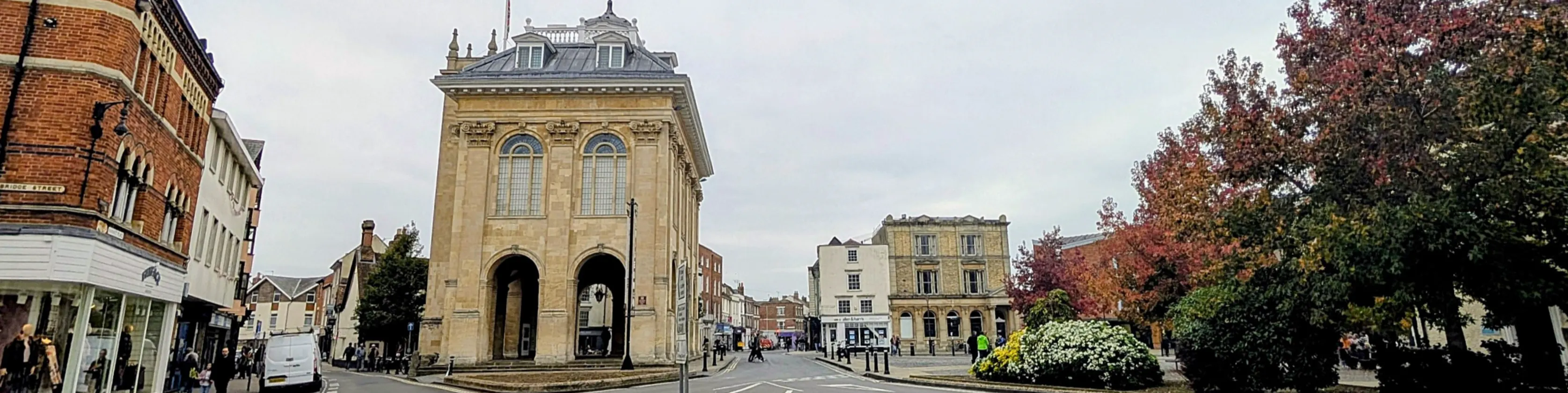
East St Helen Street active travel update
Consultation has concluded
We would like to share updates we have made to the draft plans for Abingdon East St Helen Street active travel proposals before we hold a formal consultation for the project. |
About the scheme
We were awarded a grant of £1.47m from the UK Government’s active travel fund - to improve access for walking, wheeling and cycling in Abingdon town centre. The project proposes to provide improved cycleway facilities on East St Helen Street and new crossing facilities at the junction of High Street, Bridge Street and Stert Street providing an important link through the town on National Cycle Network Route 5 (NCN5).
The scheme is also intended to help improve the feel of the town centre while complementing Abingdon's medieval market town heritage, encouraging people to enjoy spending more time in the centre of the town.
The proposals include pedestrian and cycle crossings and a section of cycle contraflow. Once completed, it is expected to contribute towards achieving a high-quality cycle network connecting Oxford, Abingdon, Didcot, and beyond. It would deliver:
- improved crossing facilities at the junction of High Street with Bridge Street and Stert Street providing access to the Market Place and Abbey Meadows
- continuous footways at side roads to prioritise pedestrian safety
- a contraflow cycle facility allowing two-way cycling for the entire length of East St Helen Street
The scheme is included in the Abingdon Local Cycling and Walking Infrastructure Plan (LCWIP), and ties in with the Oxford, Abingdon, and Didcot local cycling and walking infrastructure plans, to create a safer connection of routes for walking, wheeling and cycling across the county. The Abingdon LCWIP (February 2023) is a 10-year plan (2023 to 2033) to improve and increase cycling and walking in the town.
- Abingdon Local Cycling and Walking Infrastructure Plan (pdf format, 4 MB)
- Abingdon LCWIP maps (pdf format, 2 MB)
What we are doing now
Feedback from the October 2025 consultation helped to identify where some changes could be made to the designs. We have been successful in securing approval from the UK government's consolidated active travel fund (CATF) for a further £269,000 which enables the project scope to be slightly increased to make changes as a result of the consultation comments.
The changes are, briefly: no loss of residential parking bays, but one bay changed into a disabled bay; more loading bay space; no new planting and more and larger passing places on East St Helen Street; Lombard Street one way eastbound, with six residential parking spaces; new crossings between Parasol restaurant and The Punchbowl, and outside St Helen’s Church; and a protected southbound cycle contraflow lane on East St Helen Street from the junction with St Helen’s Court down to the junction with East St Helen Street.
In detail, the changes we are proposing to make (informed by your feedback last autumn) are:
East St Helen Street northern section:
- Eastern crossing angled to work better with St Nicholas Church corner visibility and bollards
- More cycle parking
- Loading bay outside Sue Ryder shop moved south to be directly outside shop, and shortened from 14.5m to 10m
- New 15m long loading bay outside Kings Head and Bell public house
- Cycle lane wands for the contraflow opposite Kings Head and Bell
- New crossing between Parasol restaurant and The Punchbowl public house
- Disabled bay outside Sue Ryder moved south to outside Wisteria Avenue
- Residential permit bay and dual-purpose residential permit/pay and display bays moved
East St Helen Street southern section:
- Proposed new planting removed from the plans
- Residential permit bay outside numbers 12-18 shortened at southern end by one parking space to create longer passing place at black iron gate entrance
- Dual-purpose residential permit/pay and display bays changed to residential permit only, shortened by one parking space at southern end to create longer passing place outside numbers 24/26
- New bollards and widened footway to help protect overhanging building
Lombard Street and northern section of West St Helen Street:
- Change to one-way, eastbound, from West St Helen Street to East St Helen Street
- Six new residential permit bays (4 + 2) on southern side
- Allow contraflow cycling westbound
- Change West St Helen bus stop into two new residential permit bays
West St Helen Street and St Helen's Court:
- New crossing outside St Helen’s Church – with a build-out and dropped kerbs
- Protected southbound cycle contraflow lane on West St Helen Street from junction with St Helen’s Court down to junction with East St Helen Street
- Move the four southernmost residential permit spaces (3+1) from West St Helen Street onto St Helen’s Court, on southern side
- Create one new disabled persons parking place on St Helen’s Court, on southern side
St Helen's Wharf:
- Additional cycle symbols
- Signage changes
- Slightly wider cycle lane on bridge
These changes are what we would like to hear your feedback on (you'll be able to have your say on the full project when we consult on the overall proposals in autumn 2026). We would like to hear your thoughts on these changes by 1 September 2026. Your comments on these proposed changes will help to shape the project's final design plans which we will consult on formally in autumn 2026.
The revised plan and presentation (shared at the update event) are available to view in the Documents section on this page. The documents have alt. text for people using screen readers.
Next steps
We will share a final design later in autumn/winter 2026 in a formal consultation. This will allow people to examine the design before it progresses to construction and feedback their impressions of it. A formal consultation is usually open for four weeks.
Subject to approval at a county council Cabinet Member for Decision meeting we would expect construction works to start in early 2027 and complete within six months.
During construction works, we would coordinate works to minimise the impact on the network as far as possible. Further details of this will be available when the project is at construction stage.
Background
Between 30 September and 28 October 2025 we asked local people to share their thoughts on an initial draft plan that included:
- Two new parallel cycle and pedestrian zebra crossings between Abbey Close and East St Helen Street
- Two new zebra crossings on High Street and Bridge Street linking to Market Place
- Widening the central triangular island at the junction of High Street, Bridge Street and Stert Street for new crossings
- Modifying footway outside County Hall, to fit with new crossings
- Safer walking, wheeling and cycling access at East St Helen Street and Lombard Street junction
- Contra flow cycleway on East St Helen Street
- New uncontrolled crossings on East and West St Helen Streets
- Providing areas of greening/planting on East St Helen Street
Feedback to this engagement led to us reviewing various concerns and suggestions that were raised regarding specific features of the plan (summarised in the document here). The results of these reviews are reflected in the plans shown in the documents section on the right-hand side of this page.
Please feel free to use the button below to open a blank text form where you can tell us your thoughts on the proposed updates to the Abingdon East St Helen Street active travel (NCN5) project.
Alternatively, you can email us at: ncn5-cycleroute@oxfordshire.gov.uk or write to us: Freepost OXFORDSHIRE COUNTY COUNCIL (one line in middle of envelope) and Abingdon East St Helen Street Active Travel’ on top left envelope corner. If you are not able to write to us you can call our customer services team on 01865 519800 quoting Abingdon East St Helen St active travel project and give your contact details for an officer to reply to you.
-
 Abingdon East St Helen Street updates presentation (1.26 MB) (pdf)
-
 Proposed design amendments
-
1 main section - East St Helen St jct with High St_Bridge St (2.92 MB) (pdf)
-
2 West and East St Helen Sts_St Helens Ct_St Edmunds Ln (1.83 MB) (pdf)
-
3 St Helens south section - West and East St Helen Sts_St Helens Ct and Wharf (2.64 MB) (pdf)
-
4 St Helens Wharf_Caldecott Rd (1.41 MB) (pdf)
-
Key for design amendment plans 1-4 (317 KB) (pdf)
-
-
Movement plans - travel directions
-
Parking plans
-
East St Helen St scheme event letter (105 KB) (pdf)

-
About the project
- Why is the scheme needed?
- Is planning consent required?
- How are you respecting the look and feel of Abingdon as one of the country’s most historic market towns?
- How does this help businesses and tourism?
- Why is there all this focus on active travel?
- What happened to the plan for putting in new planting?
- Where is the money coming from to pay for it?
- Is the money for design and construction or design only?
-
About access
- What are you doing to help disabled access?
- I have noticed the term ‘wheeling’. What is this?
- What would the impact on traffic be if the scheme was approved and implemented?
- Will there be any impacts on parking?
- What were the originally proposed impacts on existing parking spaces?
- Have the Abingdon fairs been considered in the scheme design?
- What will the emergency services do?
-
About infrastructure
-
About construction
-
About feedback